Cetobriga — A Roman City
Cetobriga (Latin: Cetobriga, also Caetobriga) was a Roman settlement on the shores of the Sado River estuary, active from the 1st through the 6th century AD. It housed the largest known fish-salting and garum production complex in the entire Roman Empire. The ruins survive on the Troia Peninsula, directly across the water from modern-day Setubal.
Name and Origins
The name Cetobriga has Proto-Celtic roots, deriving from *Caetobrix. The settlement was originally founded by the Turdetani — a people who inhabited the southwestern Iberian Peninsula — and later came under Roman control as part of the province of Lusitania.
[DISPUTED] The precise relationship between Cetobriga and the ruins on the Troia Peninsula remains a matter of scholarly debate. Some researchers believe that Cetobriga proper was located on the site of modern Setubal, with the Troia complex serving as its industrial annex. Others identify Cetobriga directly with the settlement on Troia. The 16th-century humanists Gaspar Barreiros and Andre de Resende, who first described the ruins, may have incorrectly equated the entire complex with Cetobriga.
The modern name of the city — Setubal — derives from Cetobriga through the intermediate Arabic form Shatubar (Andalusian Arabic: شَطُوبَر).
Timeline
- 1st century AD — beginning of industrial activity on the Troia Peninsula
- 2nd–3rd centuries — peak period of production
- 4th century — onset of decline
- 412 AD — presumed devastating earthquake and tsunami
- 5th–6th centuries — final abandonment of the complex
Geographical Setting
The archaeological complex is situated on the left bank of the Sado River, on the northwestern side of the Troia Peninsula, facing modern Setubal. An additional production site has been discovered at Creiro, within the Arrabida Natural Park, on the right bank of the estuary.
The presence of installations on both banks of the Sado was a strategic choice: the estuary provided abundant fish stocks, while salt deposits along its shores supplied the raw material for curing.
The Fish-Salting Complex
Scale of Production
The Troia ruins constitute the largest known fish-salting and fish-sauce production complex in the Roman Empire. At its peak, the estimated output reached 1.4 million litres of product per year.
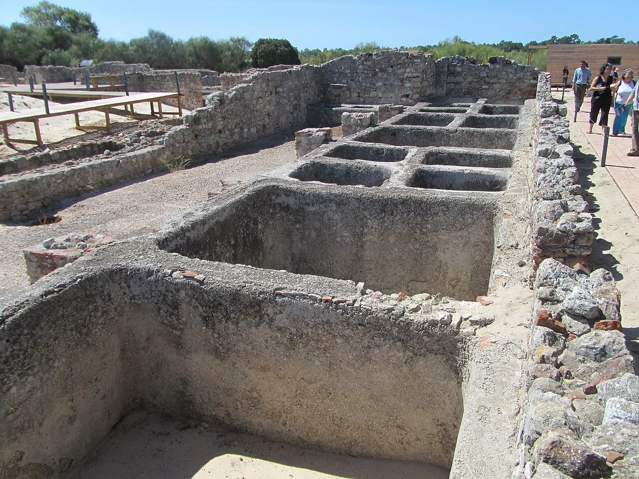
Cetariae — Salting Vats
Archaeologists have uncovered 25 workshops containing a total of 182 square vats (cetariae). The individual workshops varied considerably in size:
- The largest workshop covered more than 1,000 sq m and contained 19 vats
- The smallest spanned 135 sq m with 9 vats
At the Creiro production site, 9 vats have been found, ranging from 1 to 2.6 m in width and 0.5 to 1 m in depth. All vats were lined with opus signinum — a waterproof morite of gravel, hydraulic lime, and sand.
Garum and Other Products
Garum was a fermented fish sauce and one of the most prized condiments in Roman cuisine. Alongside garum, the Cetobriga complex also produced other varieties: liquamen, muria, and hallec (or allec) — each distinguished by its recipe and the species of fish used.
The primary raw material was the European sardine. Other species processed included herrings, sturgeon, axillary sea bream, and Atlantic mackerel.
Trade Connections
Amphorae stamped with the marks of Troia’s garum producers have been found at the farthest reaches of the empire:
- At Hadrian’s Wall in Britain
- On the Danube frontier in Austria
- In the city of Volubilis in Morocco
Around 20 pottery centres producing transport amphorae were located on the opposite bank of the river. The identification of Lusitanian amphorae in Mediterranean shipwrecks confirms the full integration of this seemingly peripheral region into the empire’s trade networks.
The production of garum links Roman Cetobriga with the later canning industry of Setubal and its fishing culture — for two millennia, the Sado River has sustained those who live on its banks.
Other Structures and Finds
Baths
Archaeologists have uncovered a bathing complex of approximately 450 sq m, which included:
- Apodyterium (changing room)
- Frigidarium (cold-water hall)
- Tepidarium (warm-water hall)
- Caldarium with an underground heating system (hypocaust)
- Bathing pools
- An exercise room
The baths demonstrate that Cetobriga was not merely an industrial site but a fully fledged settlement with developed urban infrastructure.
Residential Buildings
Villas have been found within the complex — residences both for factory owners and for workers. The living quarters were situated alongside the workshops, a layout characteristic of Roman industrial settlements.
Necropolises and Mausoleum
Four burial zones (necropolises) have been identified. Among them stands a mausoleum with a columbarium — wall niches designed to hold the urns of the cremated. The existence of multiple necropolises confirms prolonged and continuous habitation of the site.
Religious Structures
The complex has yielded evidence of several religious traditions:
- A marble Mithraic relief — found inside the basilica, attesting to the pre-Christian cult of Mithras among the workers and traders of the complex
- An early Christian basilica — built atop an abandoned fish-salting workshop, vividly illustrating the transition between eras
- Christian burials — dating to the second half of the 5th century
A rota aquaria — a water wheel used for water supply — has also been discovered.
The Fall of Cetobriga
[DISPUTED] The circumstances of the settlement’s demise remain a subject of debate.
According to one account, the Roman port city was swallowed by the sea following a devastating earthquake and tsunami in 412 AD. This date appears in several sources, though not all scholars accept it.
According to another interpretation, the settlement declined gradually as a result of Germanic tribal invasions (Suebi, Vandals, Visigoths), which transformed the political and economic landscape of the region in the 5th and 6th centuries.
Most likely, both factors played a role: the catastrophe of 412 dealt severe damage to the main settlement, but activity continued on a reduced scale for another century or two before ceasing entirely amid the broader collapse of the Roman provincial system.
The production complex at Creiro was abandoned somewhat earlier — in the late 4th to early 5th century.
What Survives Today
The Archaeological Park at Troia
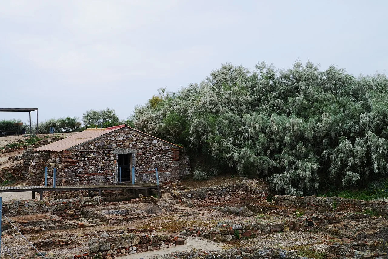
The ruins are open to visitors on the Troia Peninsula under the name Ruinas Romanas de Troia. They rank among the foremost historical and archaeological attractions of the Setubal region.
Excavation History
- 16th century — first descriptions of the ruins by humanists Gaspar Barreiros and Andre de Resende
- 1948–1967 — first major systematic excavations
- From 2006 — resumption of archaeological work (excavation and conservation)
The Creiro Ruins
The fish-salting vats at Creiro are accessible within the Arrabida Natural Park.
Significance
Cetobriga holds a special place in the history of the Setubal region. It demonstrates that an economy founded on fishing and the processing of marine resources took root here long before the medieval and early modern periods. The production of garum on the banks of the Sado from the 1st through the 6th century was, in essence, the forerunner of Setubal’s canning industry in the 19th and 20th centuries: the same river, the same fish, the same salt — separated by a millennium and a half.
The sheer scale of the complex — 182 vats, 25 workshops, 1.4 million litres of output per year — makes it the largest known fish-processing centre of the ancient world and a key site for understanding the economy of the Roman Empire.
Image sources
- cetobriga-ruins-troia.webp — Ruins of the Roman complex on the Troia Peninsula. Author: Sanjorgepinho. License: CC BY-SA 4.0. Source
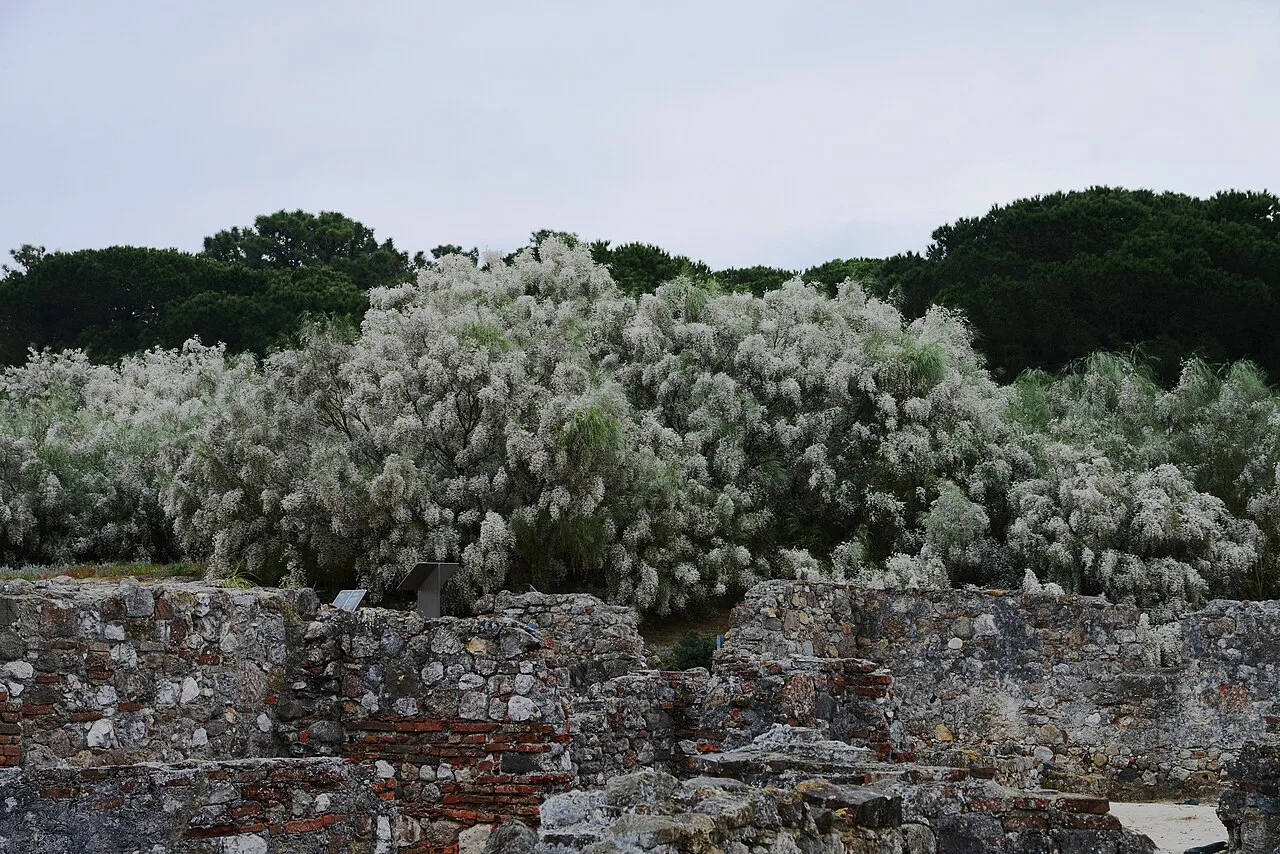
- cetobriga-ruins-landscape.webp — Landscape of the Cetobriga ruins. Author: Roundtheworld. License: CC BY-SA 4.0. Source
- cetobriga-cetarias-salting.webp — Cetariae (salting vats) of Cetobriga. Author: CorreiaPM. License: Public domain. Source
See also
- Roman Ruins of Troia
- Troia Peninsula
- Sado Estuary
- Arrabida Natural Park
- The Canning Industry
- Fishing Culture
- The Moorish Period
If this article was useful — help us write the next one.
☕ Support on Ko-fi