The 1858 Earthquake
November 11, 1858. The earth shook, and in a few seconds the fishing quarter of Troino turned into piles of stone. Throughout Setúbal walls collapsed and churches cracked. But from this catastrophe the city emerged with new houses—and on each of them preserved a ceramic tile with inscription that can be read today: “Beneficência 11 de novembro de 1858.”
Background: Seismic Context
Setúbal in Risk Zone
Setúbal is located in seismically active region—at junction of African and Eurasian tectonic plates. Proximity to fault zone running through Atlantic south of Portugal makes city vulnerable to earthquakes.
Most destructive in Setúbal’s history was 1755 earthquake—catastrophe that destroyed Lisbon and inflicted severe damage on southern Portugal. However, a century later the city awaited new catastrophe, less known but no less significant for its history.
November—Dangerous Month
Notably, both largest earthquakes in Setúbal’s history occurred in November: November 1, 1755 and November 11, 1858. This coincidence is of course accidental, but it became fixed in folk memory, giving November ominous reputation in Setúbal folklore [FOLKLORE].
Earthquake of November 11, 1858
Parameters
- Date: November 11, 1858
- Estimated magnitude: about 7.1 on Richter scale (by modern reevaluations—M ~ 7)
- Epicenter: in Atlantic Ocean, approximately 30 kilometers south of Setúbal
- Intensity in Setúbal: VIII-IX on Mercalli scale (from severe damage to catastrophic)
- Felt: throughout Portugal and significant part of Iberian Peninsula
Academic study of 2021 (Pure and Applied Geophysics) conducted reevaluation of earthquake parameters, confirming its significant magnitude and coastal epicenter.
Scale of Destruction
The earthquake inflicted severe damage on Setúbal—destruction recorded on virtually all city streets:
- Troino Quarter—old fishing district built with dilapidated low-rise houses, was almost completely destroyed. Troino, already a poor district, proved most vulnerable due to weak soils (alluvial deposits near estuary) and low construction quality
- Largo da Fonte Nova—square and adjacent buildings received serious damage
- São Julião Church—one of city’s oldest churches—was damaged: walls cracked, structure weakened
- Numerous residential buildings—throughout city walls, roofs, floors collapsed
Casualties
Number of dead was at least 6 people (by some sources—up to 8). Given scale of destruction, this number may seem relatively low. Possibly this is explained by many residents being outdoors at moment of tremor—on fishing boats, at port, at market—and also by tremors not being instantaneous and giving people time to leave buildings.
Anomalies in Sado Estuary
Historical records document anomalous activity in Sado River mouth after earthquake. Unusual water disturbances resembling tsunami were noted, which led to flooding of several boats. Academic study of 2021 considers this evidence as possible confirmation of local tsunami caused by underwater landslide or tectonic displacement.
Consequences for Population
After earthquake, significant part of Setúbal’s population was left homeless. People whose houses were destroyed set up camp on beach, pitching tents. Attempts at looting in destroyed buildings were also reported, which had to be suppressed.
Reconstruction
Scale of Work
Setúbal’s reconstruction after 1858 earthquake took more than two years. During this time 181 residential buildings were restored or newly built—significant part of city housing stock.
Materials from Palmela Monastery
[UNVERIFIED] According to local tradition, for reconstruction of destroyed buildings building materials—stone, brick, tiles—were used from semi-ruined structures of Palmela Monastery (Convento de Palmela), former Order of Santiago residence. The monastery, damaged by 1755 earthquake, by mid-19th century was in semi-abandoned state. Using its materials for Setúbal restoration was pragmatic decision: why extract new stone when nearby stand ruins full of suitable material?
Azulejo “Beneficência 11 de novembro de 1858”
Most noteworthy reconstruction detail is ceramic tiles (azulejo) with inscription “Beneficência 11 de novembro de 1858” (Charity November 11, 1858), installed on each restored house.
These azulejos had double significance:
- Charity marker—inscription indicated house was restored with charitable funds, not owner’s personal means. This was testimony of public solidarity—help city provided to victims
- Historical memory—tiles fixed catastrophe date on house facades, turning each restored building into memorial
Some of these azulejos survive on Setúbal building facades to this day and are part of city’s historic appearance. They are material evidence of catastrophe and restoration, readable by passersby more than a century and a half later.
Scientific Significance
2021 Reevaluation
The 1858 earthquake long remained little studied against backdrop of catastrophic 1755 earthquake. However, in 2021 a group of scientists published in journal Pure and Applied Geophysics study “Reevaluation of the 11 November 1858 Earthquake and Tsunami in Setúbal: A Contribution to the Seismic and Tsunami Hazard Assessment in Southwest Iberia.”
The study:
- Reevaluated earthquake magnitude using modern methods
- Analyzed tsunami evidence in Sado mouth
- Assessed seismic hazard for region considering data on this event
- Showed 1858 earthquake important for forecasting future seismic activity
Soil Seismic Studies
Modern research (ScienceDirect, 2021) studied seismic site effects in Setúbal area using ReMi (Refraction Microtremor) method. Results confirmed certain city areas—especially with alluvial soils near estuary (including Troino)—amplify seismic vibrations, explaining disproportionately severe 1858 destruction.
Comparison with 1755 Earthquake
| Characteristic | 1755 | 1858 |
|---|---|---|
| Magnitude | ~8.5-9.0 | ~7.0-7.1 |
| Epicenter | Atlantic, far offshore | ~30 km from Setúbal |
| Scale | Catastrophic (all Portugal) | Regional (Setúbal area) |
| Tsunami | Destructive | Local, in estuary |
| Casualties in Setúbal | Significant | 6-8 people |
| Reconstruction | Pombaline rebuilding | Local, with charity |
Paradoxically, for Setúbal itself the 1858 earthquake, despite smaller magnitude, was more “personal” disaster: epicenter was closer, destruction more concentrated, and restoration entirely in hands of city and its residents.
Legacy
Urban Landscape
The 1858 earthquake left noticeable trace on Setúbal’s urban landscape. Many buildings in Troino district and city center date from 1860s—these are reconstruction structures erected on site of destroyed ones. Azulejo “Beneficência” on facades—silent witnesses of catastrophe woven into city’s everyday appearance.
Seismic Vulnerability
The 1858 earthquake is reminder of Setúbal’s seismic vulnerability. City is located in zone where destructive earthquakes occurred repeatedly (1755, 1858, less significant tremors in 20th century), and question “when will be next” remains relevant. Modern seismic hazard studies directly indicate need to consider 1858 experience when planning urban development and preparing for emergencies.
Cultural Memory
In Setúbal’s collective memory, 1858 earthquake occupies special place—less dramatic than 1755 catastrophe, but more “own,” more close. This is event reminded not by history textbooks but by house walls past which residents walk daily.
Image sources
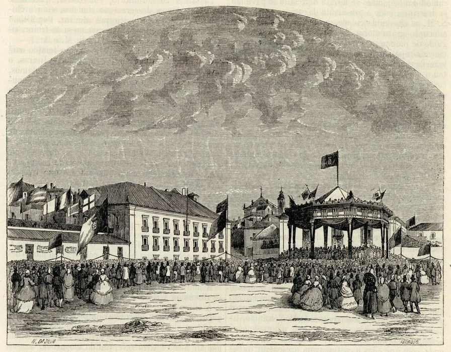
- setubal-1860.webp — View of Setúbal around 1860, shortly after reconstruction. Source: Wikimedia Commons.
See Also
- 1755 Earthquake—preceding catastrophe
- 1249 Charter and Order of Santiago—medieval history partly lost due to 1910 archive fire
- Setúbal Toponymy—reflection of history in urban names
- Palmela Castle—source of building materials for reconstruction
The light is on for free. But someone has to clean the lantern.
☕ Support on Ko-fi