Arrábida Hiking Trails
📷 Image credit
Photo: Ivan Ruggiero (Ivanbranco) / Wikimedia Commons / CC BY-SA 4.0
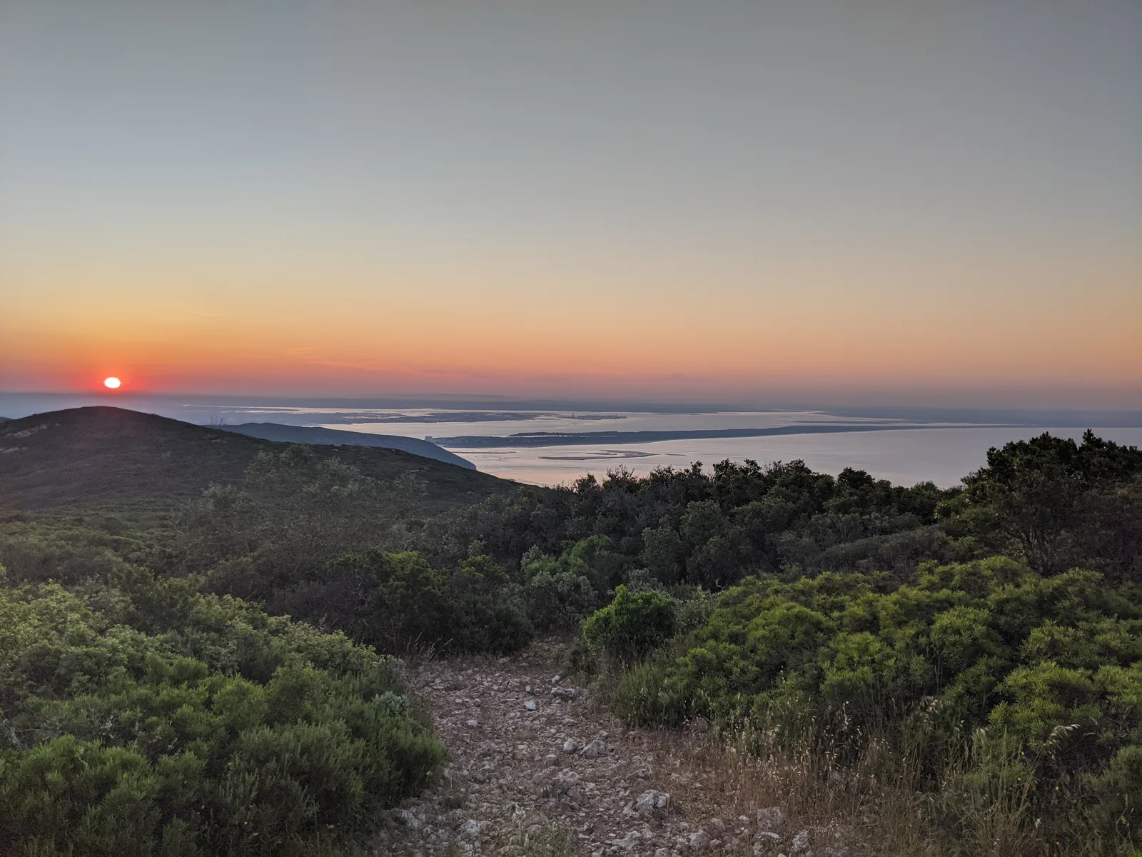
The trail network of the Arrábida Natural Park spans approximately 44 km, weaving through limestone mountains, Mediterranean forests, vineyards and fishing coves. Four official routes (PR1–PR4 STB) are supplemented by regional trails in the municipalities of Palmela and Sesimbra. Since September 2025, the park has held UNESCO Biosphere Reserve status.
Official trails (Arrábida Walking Trails)
The trails are classified as PR (Pequena Rota – short route) under the system of the Portuguese Camping and Mountaineering Federation (FCMP). Difficulty is rated on the MIDE scale (1 to 5).
PR1 STB – Encostas de São Filipe
| Parameter | Value |
|---|---|
| Length | ~4 km |
| Type | Circular |
| Difficulty | Easy (MIDE 1–2) |
| Duration | ~1.5 h |
| Start | Albarquel city park, Setúbal |
A gentle walk along the slopes of São Filipe hill with views over the Bay of Setúbal and the Sado estuary. Suitable for families with children.
PR2 STB – Alto do Formosinho
| Parameter | Value |
|---|---|
| Length | 8.3 km |
| Type | Linear |
| Difficulty | Very hard (MIDE 4–5) |
| Duration | ~4 h |
| Start | Praça da República, Vila Nogueira de Azeitão |
| Finish | Road N379-1, Portinho da Arrábida |
The most challenging and scenic trail in the park. It leads to the summit of Alto do Formosinho (501 m) – the highest point of Serra da Arrábida. The ascent from Azeitão is extremely demanding: rocky outcrops, steep slopes and sections bordering on scrambling. Recommended only for experienced hikers.
From the summit – a 360° panorama: to the north, valleys and Palmela Castle; on clear days, Lisbon; to the south, the Atlantic Ocean and the Troia Peninsula.
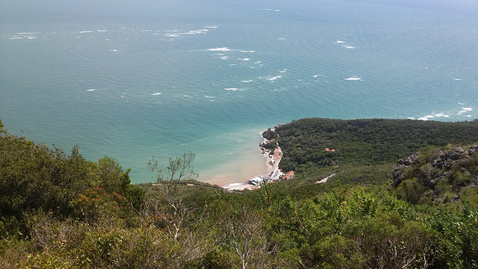
PR3 STB – Portinho da Arrábida
| Parameter | Value |
|---|---|
| Length | 1.3 km |
| Type | Linear |
| Difficulty | Very easy (MIDE 1) |
| Duration | ~30 min |
| Start | Car park near the Creiro archaeological site |
A short path to Portinho da Arrábida cove. Suitable for all ages.
PR4 STB – Aldeias de Azeitão
| Parameter | Value |
|---|---|
| Length | 17 km (short version: 11.2 km) |
| Type | Circular |
| Difficulty | Moderate (MIDE 2–3) |
| Duration | 4–5 h |
| Start | Praça da República, Vila Nogueira de Azeitão |
The longest trail passes along the northern slopes through historic villages: Aldeia Rica, Oleiros, Aldeia de Irmãos, Piedade, Portela, São Pedro, Casais da Serra and Picheleiros. Vineyards, olive groves and rural estates – all in the shadow of Serra da Arrábida. Azeitão is the home of the renowned cheese and Moscatel wine.
Regional trails
Convento da Arrábida route (Rota do Convento)
| Parameter | Value |
|---|---|
| Length | ~6.3 km (round trip) |
| Elevation gain | ~374 m |
| Difficulty | Moderate |
| Duration | 2.5–3 h |
A trail from Portinho da Arrábida beach to the 16th-century Franciscan monastery (Convento de Nossa Senhora da Arrábida). It passes through cork oak woods and wild rosemary. The monastery is not a single building but an entire “hermit settlement” of cells, chapels and stone paths along the hillside.
The monastery is open for visits on Wednesdays, Saturdays and Sundays only, strictly by prior booking.
Serra do Risco e Trilho da Falésia (Cliff trail)
| Parameter | Value |
|---|---|
| Length | ~11.7 km |
| Type | Circular |
| Difficulty | Hard (MIDE 3–4) |
| Duration | 3.5–4 h |
| Start | Palácio do Calhariz, Sesimbra |
Leads to Serra do Risco – the highest limestone sea cliff on mainland Portugal (380 m at the Píncaro point). The landscape is predominantly low scrub (maquis) with open stretches and stunning views of cliffs and ocean.
Trilho da Serra do Louro (Mills trail)
| Parameter | Value |
|---|---|
| Length | ~13 km |
| Type | Circular |
| Difficulty | Moderate (MIDE 3) |
| Duration | ~2.5 h |
| Start | Serra do Louro / Palmela |
A route along the Serra do Louro ridge with its windmills. It passes the Chibanes archaeological site (settlement from the 3rd–1st centuries BC) and the village of Quinta do Anjo.
Trilho das Serras e Moinhos (Mountains and mills)
A long linear trail (~22 km, MIDE 4) crossing Serra do Louro, Vale dos Barris and Serra de São Luís. For fit hikers (~6 h).
Viewpoints
| Name | Altitude | View |
|---|---|---|
| Alto do Formosinho | 501 m | 360° panorama: Lisbon, Palmela, Troia, the ocean |
| Miradouro do Norte | ~400 m | Green valleys and Palmela Castle (north); Troia (south) |
| Miradouro do Portinho | ~350 m | Wooden platform above the bay – a sensation of floating over the landscape |
| Convento da Arrábida | ~300 m | Southern slope and sea from the monastery grounds |
| Píncaro (Serra do Risco) | 380 m | The highest limestone coastal cliff in Portugal |
Flora and fauna along the trails
Flora
The park contains over 1,400 plant species (~40% of Portugal’s flora), including 70 rare and endemic species. Three floristic elements converge:
- Euro-Atlantic vegetation – on the moist northern slopes
- Mediterranean vegetation (maquis) – on the dry southern slopes
- Macaronesian vegetation – on coastal sections
Rare species: Narcissus calcicola (an endemic daffodil), Withania frutescens, Lavatera maritima. In spring (March) orchids bloom: champagne, conical, man orchid and others.
Fauna
Approximately 200 vertebrate species. Along the trails you may spot:
- Bonelli’s eagle (Aquila fasciata) – a nesting pair on the cliffs
- Peregrine falcon (Falco peregrinus)
- Alpine swift (Apus melba)
- Red fox, wild boar
Geology
The trails traverse a limestone massif of Jurassic and Miocene age (180+ million years). Notable features:
- Over 100 caves and grottos – the result of karst processes
- Gruta do Frade (Monk’s Cave) – the main speleological attraction
- Lapa de Santa Margarida – a grotto with a 17th-century chapel inside; the walls display fossils in Miocene biocalcarenites; 200 stone steps down to the sea
- From Formosinho summit (501 m) to the sea – just 1 km horizontally, one of the most dramatic elevation drops in Portugal
More on Serra da Arrábida geology.
Practical information
Best season
| Season | Rating | Features |
|---|---|---|
| Spring (Mar–May) | Best | Orchid and wildflower bloom; 15–22°C |
| Early autumn (Sept–Oct) | Excellent | Mild weather, fewer tourists |
| Winter (Dec–Feb) | Acceptable | Quiet, some rain |
| Summer (Jun–Aug) | Not recommended | Heat 30–35°C+, fire restrictions, closed roads |
Optimal period: September – June.
Rules and restrictions
- Stay on marked trails only (FCMP waymarks – yellow and red)
- Prohibited: wild camping, fires, picking plants, disturbing wildlife
- Drones – require prior permission from the park authority
- In summer, parts of the park may temporarily close due to fire risk
- Coastal roads are closed to private vehicles in summer (07:00–19:00)
- Some zones are accessible only with an official ICNF guide
Recommendations
- Carry water, especially on Serra do Risco and Alto do Formosinho routes (little shade)
- Sunscreen even in cool weather
- Sturdy footwear for rocky paths
- Check current information at Arrábida Walking Trails before setting out
📷 Image credit
Photo: Pepolino83 / Wikimedia Commons / CC BY-SA 4.0
See also
- Arrábida Natural Park
- Serra da Arrábida Geology
- Professor Luiz Saldanha Marine Park
- Galapinhos Beach
- Convento da Arrábida
- Water Sports in the Arrábida Region
- Cabo Espichel
If this article was useful — help us write the next one.
☕ Support on Ko-fi