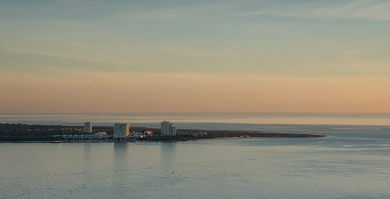
Troia Peninsula
The Troia Peninsula (Peninsula de Troia) is a narrow sand spit roughly 21 km long, lying opposite the city of Setubal and separating the Sado Estuary from the Atlantic Ocean. It combines pristine dune landscapes, long stretches of white beach, the largest fish-salting complex of the Roman Empire, and a modern resort district.
Geography
Geomorphology
The Troia Peninsula is a sand spit – an accretionary landform shaped by the transport of sand by marine currents and wind. It extends approximately 21 km in length and ranges from a few hundred metres to several kilometres in width.
The western side faces the Atlantic Ocean; the eastern side looks over the waters of the Sado Estuary. The northern tip lies opposite Setubal, with the strait between them measuring roughly 3.9 km.
The relief is defined by mobile and stabilised dunes of various ages, interspersed with pine woodland. Geomorphological studies have documented a complex history of aeolian (wind-driven) sedimentation that has shaped the peninsula over millennia.
Coordinates
Northern tip of the peninsula: approximately 38.49° N, 8.88° W.
Ecosystem
Dune vegetation
The peninsula’s vegetation is arranged in clearly defined zones that succeed one another with increasing distance from the ocean shore:
- Strand line – pioneer species such as European sea rocket (Cakile maritima)
- Embryonic dunes – colonised by sand couch grass (Elymus farctus) and cottonweed (Otanthus maritimus)
- Primary (white) dunes – stands of marram grass (Ammophila arenaria), the chief stabiliser of mobile sands
- Secondary (grey) dunes – aromatic shrubs
- Stabilised ancient dunes – larger shrubs: white broom (Lygos monosperma), common juniper (Juniperus communis), as well as stone pine and maritime pine
The pine woodland on the ancient dunes includes stone pine (Pinus pinea) and maritime pine (Pinus pinaster), along with mastic tree (Pistacia lentiscus), sea thrift (Armeria maritima) and Portuguese crowberry (Corema album). Among the rare species are Linaria ficalhoana and Ionopsidium acaule.
Dune vegetation is extremely fragile. To protect the dune flora from trampling, raised wooden boardwalks link the beaches to the infrastructure zones.
Fauna
Shorebirds: In winter, the peninsula’s shores are visited by flocks of sanderlings (Calidris alba), which migrate northward to the Arctic in spring to breed.
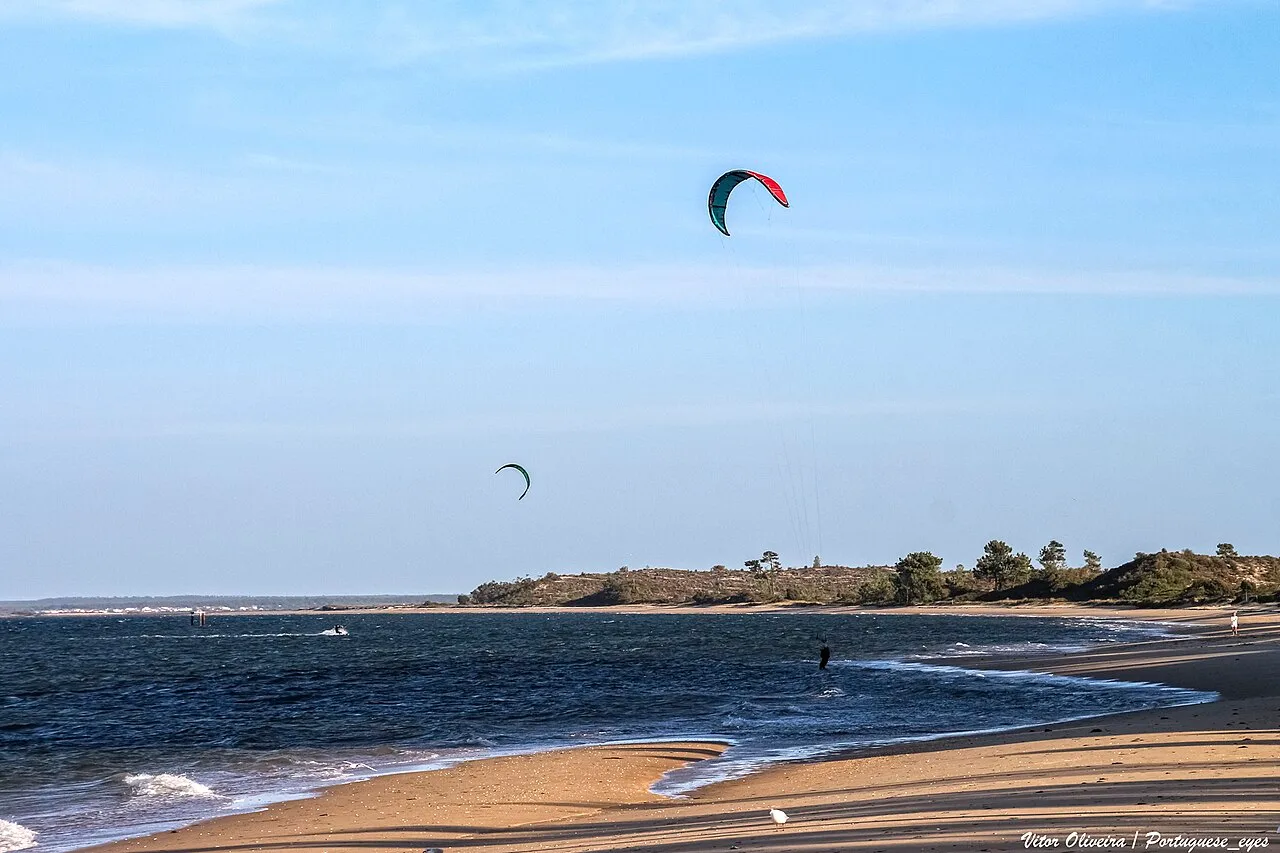
Marine fauna: Along the estuary-facing shore, underwater seagrass meadows serve as nurseries for seahorses, cuttlefish, molluscs and other species.
Dolphins: The resident bottlenose dolphin population is regularly observed in the waters off the peninsula’s northern tip.
Ecological significance
The peninsula performs a crucial barrier function: by shielding the estuary from the direct force of the Atlantic, it has created the conditions for a lagoonal system of mudflats and salt marshes – habitats of outstanding biodiversity. The area falls within the Natura 2000 network and is part of the Sado Estuary Natural Reserve.
Historical heritage
Roman ruins of Troia
On the north-western side of the peninsula, facing Setubal, lie the ruins of the largest fish-salting complex in the Roman Empire – an archaeological site dating from the 1st to the 6th century AD.
History
In antiquity, the peninsula was probably an island known as Acala. Phoenicians were the first to settle it, and the Romans subsequently turned it into a major fish-processing centre. The abundance of fish and salt in the Sado Estuary gave rise to a fishing industry that spanned Cetobriga (the Roman name for present-day Setubal) and the Troia peninsula. Salted and marinated fish, together with fish sauces – including the celebrated garum – were exported throughout the Roman Empire in specially made amphorae.
Archaeological finds
Archaeologists have uncovered between 20 and 25 workshops containing 182 square tanks (cetariae) used for salting and fermenting fish. Port facilities, baths with remnants of mosaics and marble revetment, and burials have also been identified.
Chronology of excavations
- Late 18th century – the first known excavations, under Princess Maria I
- 1850 – investigations by the Lusitanian Archaeological Society
- 1948–1967 – systematic excavations by the National Museum of Archaeology and the General Directorate of Cultural Heritage
Conservation status
The ruins have been classified as a National Monument of Portugal since 1910. The site is included on the UNESCO World Heritage Tentative List as a property of outstanding universal value.
Modern development
Troia Resort
Virtually the entire peninsula is owned by Sonae SGPS – one of Portugal’s largest business groups. Its subsidiary Sonae Capital is the developer of the Troia Resort complex, which occupies 486 hectares (roughly 50% of the peninsula’s total tourism zone).
Sonae has invested approximately 400 million euros in the project, including:
- A complete overhaul of the peninsula’s infrastructure
- Renovation of hotels and the golf course
- Construction and sale of 546 tourist and residential units
- Renewal of the Atlantic Ferries fleet
The Troia Tourism Development Zone covers 1,057 hectares with a building density of just 6%. The current project envisages around 15,300 bed-places – five times fewer than originally planned.
Key resort facilities
- Troia Design Hotel – a five-star hotel (61 rooms, 144 residential suites), owned by Sonae and co-managed with Oxy Capital
- Casino de Troia – casino
- Troia Golf – a golf course designed by Robert Trent Jones (founded about 40 years ago). Recognised by Rolex in 2011 as one of the finest courses in the world; ranked 8th in continental Europe by Golf World magazine in 2019.
- One Troia Jose Mourinho Training Centre – a sports training centre
- Marina – a harbour for yachts and boats
Transport links
Setubal–Troia ferry crossing
The crossing is operated by Atlantic Ferries – a fleet of two ferries and two catamarans making approximately 16,000 trips per year with a punctuality rate above 99%.
| Vessel type | Crossing time | Carries | Schedule |
|---|---|---|---|
| Catamaran | ~15 minutes | Foot passengers only | Runs almost round the clock (06:20–04:00) |
| Ferry | ~25 minutes | Cars, bicycles, passengers | 07:30–22:00 (varies by season) |
Terminals:
- In Setubal: ferry – Doca do Comercio (Avenida Jaime Rebelo); catamaran – Cais 3 (Rua Teotonio Banha)
- On Troia: ferry – Cais Sul; catamaran – at the Troia marina
Distance across the strait: approximately 3.9 km.
What to see
Beaches
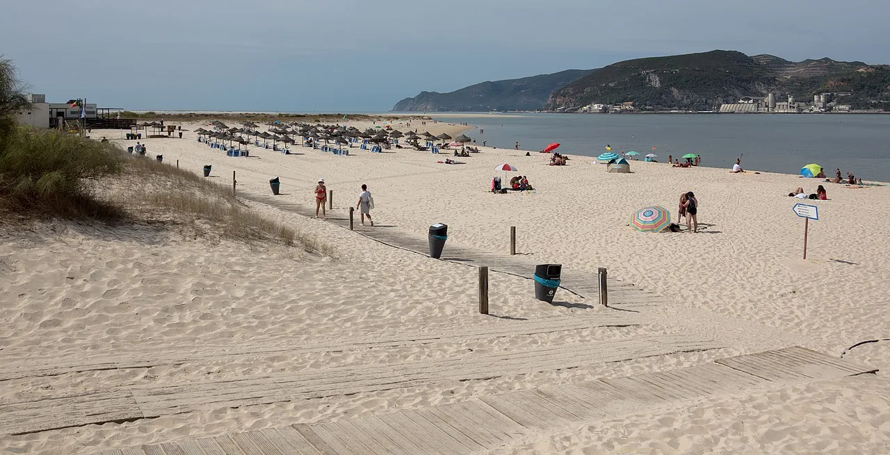
The Atlantic side of the peninsula is a continuous strip of white sand stretching more than 15 km, with clear water. Troia’s beaches are considered among the best in the Setubal region and are significantly less crowded than those of Arrabida.
Roman ruins
The archaeological complex is open to the public. Visible features include fish-salting tanks, the remains of baths with fragments of mosaics, and burials.
Nature watching
- Dolphins – sometimes visible from shore at the peninsula’s northern tip
- Shorebirds – along the surf line
- Dune vegetation – wooden walkways pass through the dune landscapes
Practical information
- Getting there: By ferry from Setubal (15–25 minutes) or by road from Alcacer do Sal / Grandola via the bridge over the Sado and then the EN253-1 (a considerable detour). The ferry crossing is the main and most convenient option.
- Best time to visit: Summer (June–September) for beach holidays; spring and autumn for walks, exploring the ruins and nature watching.
- Restrictions: Dune vegetation is protected – walking on the dunes outside the wooden boardwalks is prohibited. Part of the territory lies within the Sado Estuary Natural Reserve.
- Accommodation: Troia Design Hotel (5-star), Troia Resort apartments and other options on the near side of the peninsula.
Environmental issues
Balancing development and conservation
The Troia Peninsula is a case study in the attempt to reconcile large-scale resort development with the preservation of a fragile dune ecosystem. The low building density (6%) and the fivefold reduction in originally planned bed-places reflect certain ecological compromises. Even so, the growth of tourist traffic inevitably increases human pressure on the dunes, pollution of estuarine waters and disturbance to the dolphins.
Erosion
As a sandy accretionary landform, the peninsula is subject to natural processes of erosion and deposition, which may intensify under climate change and rising sea levels.
Image sources
- troia-peninsula-panorama.webp — Panorama of the Troia peninsula. Author: Sarunas Burdulis. License: CC BY-SA 2.0. Source
- playa-troia-mar.webp — Troia Mar Beach. Author: Diego Delso. License: CC BY-SA 4.0. Source
- estuario-sado-troia.webp — Sado Estuary from the Troia side. Author: Vitor Oliveira. License: CC BY-SA 2.0. Source
See also
- Sado Estuary
- Sado Dolphins
- Arrabida Natural Park
- Roman ruins of Troia
- Cetobriga – the Roman city
- Pine Forests of Troia and the Sado Basin — mycorrhizal fungi of the maritime pine forests on the Troia peninsula (Mushroom Encyclopedia)
If this article was useful — help us write the next one.
☕ Support on Ko-fi